

We produce a cm level accurate 3D model of your event site
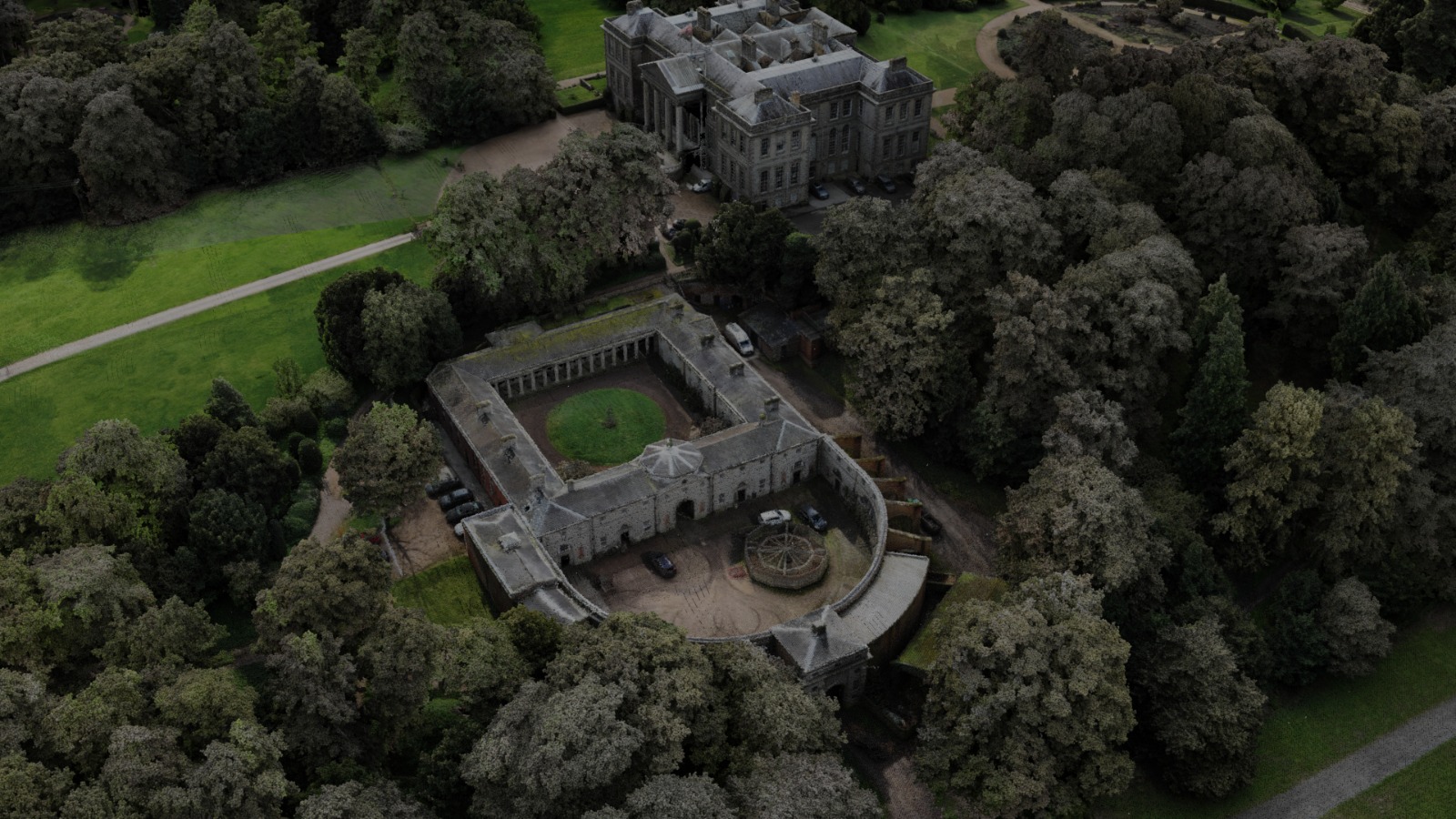
Using the very latest aerial laser scanning technology we produce highly accurate 3D models of your location. The image below is actually a 3D model of Ragley Hall with hundreds of millions of points of information. Tree heights, road widths and ground make up can be explored with high accuracy.
Example uses
Ground makeup
Explore how the ground level changes, dips and undulations, areas to avoid.
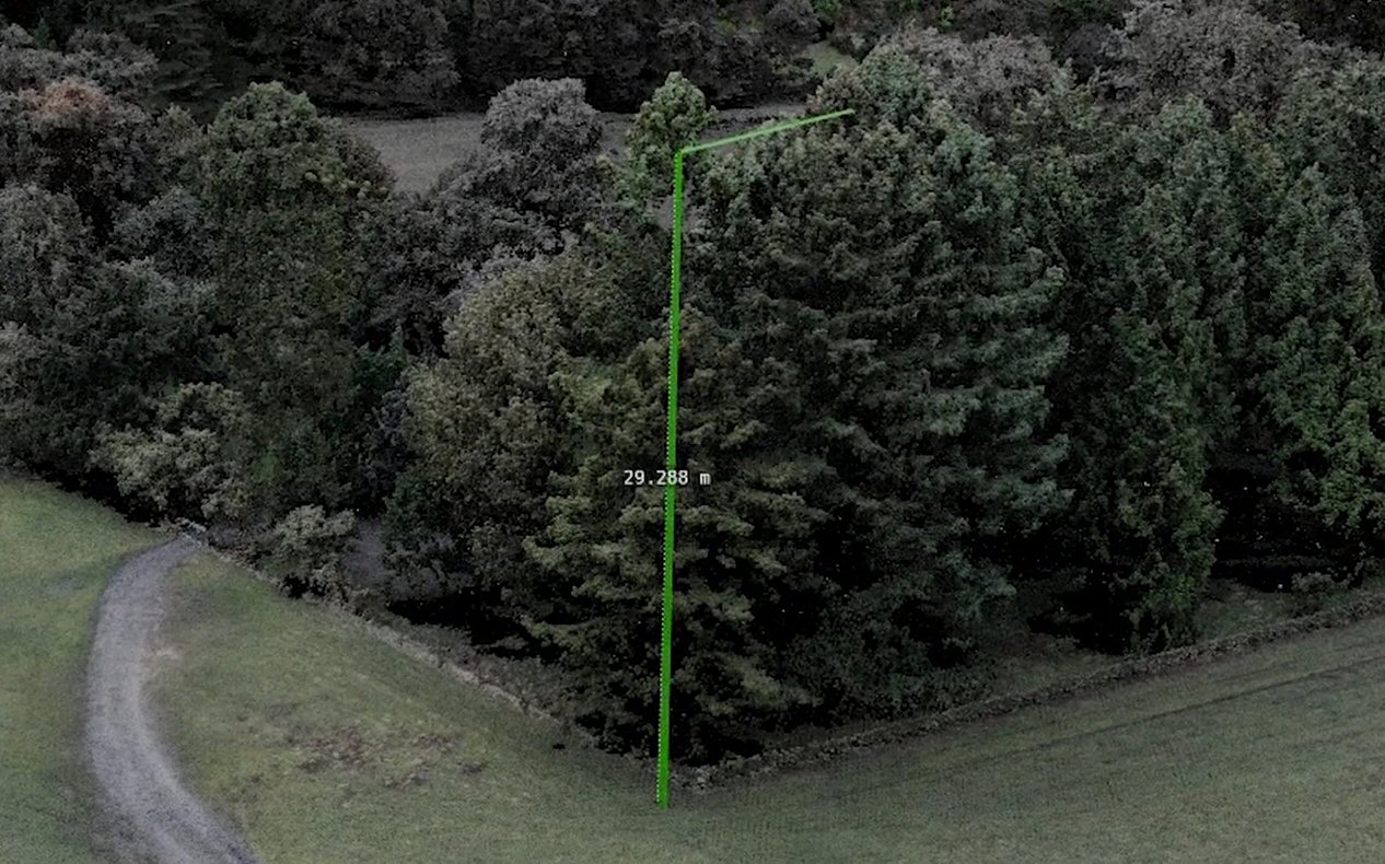
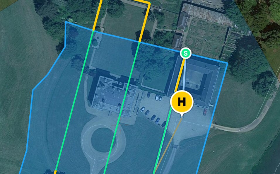
Measurement
Measure all aspects in all planes – height of tree’s, width of roadways, distances on site. Using actual data not an older satellite image where things change.
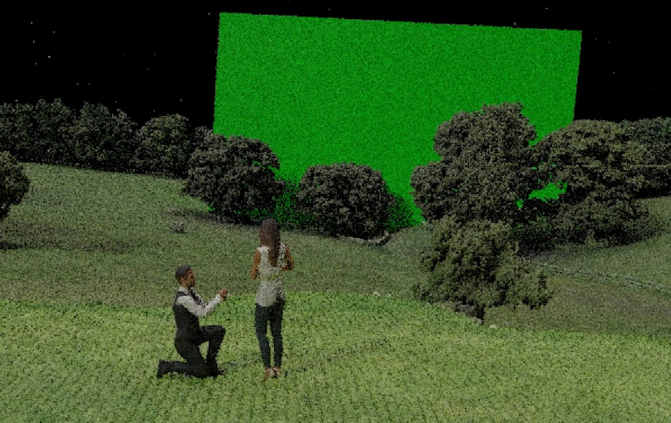
Viewpoint exploration
Want to know whether you can see the fireworks when stood 10m from your stage? Want to know if the audience can see the venue behind those trees?